
We’re frequently wanting to label points in our scatter plots but they almost always overlap! 😠 Enter my addTextLabels() function.
addTextLabels() is part of my basicPlotteR R package and allows you to add non-overlapping labels to points on a plot.
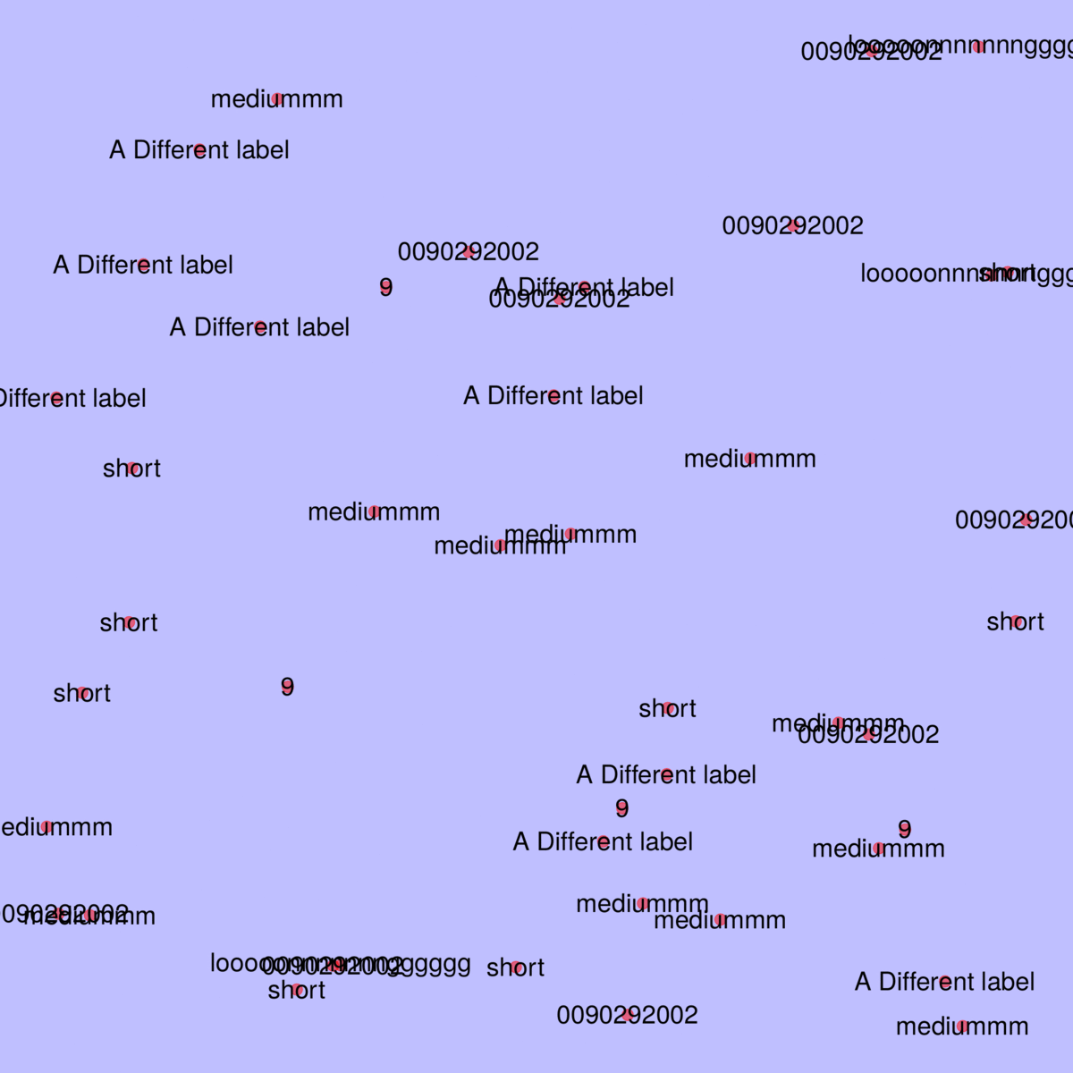
The gif below shows addTextLabels() in action and compares it to the base R function
To create these plots, generate some random points with:
    # Create some random points
    n <- 45
    testLabels <- c("short", "mediummm", "looooonnnnnnngggggg", "0090292002", "9", "A Different label")
    coords <- data.frame(X=runif(n), Y=runif(n, min=0, max=100), Name=sample(testLabels, size=n, replace=TRUE), stringsAsFactors = FALSE)
Then you can remove the margins and set the background colour - only just figured out how to do this!! 🎉
    # Set the margins
    par(mar=c(0.5,0.5,0.5,0.5))

    # Set the background colour
    par(bg = rgb(0,0,1, 0.25))
Lastly, make the three plots:
- Using the
baseRtext()function - Using
addTextLabels()without any formatting - A spruced up use of
addTextLabels()
    # With potentially overlapping labels
    plot(x=coords$X, y=coords$Y, pch=19, bty="n", xaxt="n", yaxt="n", xlab="", ylab="", cex=2, col=rgb(1,0,0, 0.5))
    text(coords$X, coords$Y, labels=coords$Name, xpd=TRUE, cex=2)

    # Plot them with non-overlapping labels
    plot(x=coords$X, y=coords$Y, pch=19, bty="n", xaxt="n", yaxt="n", xlab="", ylab="", cex=2, col=rgb(1,0,0, 0.5))
    addTextLabels(coords$X, coords$Y, coords$Name, cex.label=2, col.label="black", lty=2, col.line=rgb(0,0,0, 0.5))

    # Plot them with non-overlapping labels
    plot(x=coords$X, y=coords$Y, pch=19, bty="n", xaxt="n", yaxt="n", xlab="", ylab="", cex=2, col=rgb(1,0,0, 0.5))
    addTextLabels(coords$X, coords$Y, coords$Name, cex.label=2, col.background=rgb(0,0,0, 0.5), col.label="white", lty=2, col.line=rgb(0,0,0, 0.5))
A method to avoid overlapping text labels already exists within the ggplot package (ggrepel), but I was keen to write my own that will work with base R plots.
It took me a wee while to get my method to work but the final version works with the following steps:
- Create a plot that you want to label
- Create a set of labels and coordinates to match points on plot
- Create a set of alternative coordinates on a grid, within the limits of current plot (use
par("usr")to get axis limits) - Remove alternative coordinates within the space designated for each point’s label (I used the
strheight()andstrwidth()functions for this) - Add labels to plot if they don’t overlap with any other point’s label.
- If a label will overlap, search the laternative coordinates from closest to farthest, once found:
- Add a text label at the chosen location and plot a line back to the original point
- Remove any of the alternative label locations that would overlap with the chosen location and its label
- Change the point’s coordinates to be those of the alternative location
There is still work to be done on this function but give it a go and let me know what you think. You just need to download my basicPlotteR package:
# Install the devtools package to install packages from GitHub
install.packages("devtools")

# Install my basicPLotteR package directly from GitHub
devtools::install_github("JosephCrispell/basicPlotteR")

# Load it!
library(basicPlotteR)

# Get cracking!!